


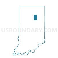
LIBERTY 02, Wabash County, Indiana
About
Outline

Summary
| Unique Area Identifier | 581079 |
| Name | LIBERTY 02 |
| County | Wabash County |
| State | Indiana |
| Area (square miles) | 33.13 |
| Land Area (square miles) | 33.07 |
| Water Area (square miles) | 0.06 |
| % of Land Area | 99.83 |
| % of Water Area | 0.17 |
| Latitude of the Internal Point | 40.70356210 |
| Longtitude of the Internal Point | -85.68993260 |
Maps


Graphs
Select a template below for downloading or customizing gragh for LIBERTY 02, Wabash County, Indiana


Neighbors
Neighoring Voting District (by Name) Neighboring Voting District on the Map
- LAGRO 01, Wabash County, IN
- LIBERTY 01, Wabash County, IN
- NOBLE 10, Wabash County, IN
- PLEASANT 01, Grant County, IN
- POLK TOWNSHIP, Huntington County, IN
- WALTZ, Wabash County, IN
- WASHINGTON 01, Grant County, IN
- WAYNE TOWNSHIP, Huntington County, IN
Top 10 Neighboring County Subdivision (by Population) Neighboring County Subdivision on the Map
- Noble township, Wabash County, IN (14,230)
- Pleasant township, Grant County, IN (6,797)
- Washington township, Grant County, IN (3,803)
- Lagro township, Wabash County, IN (2,894)
- Liberty township, Wabash County, IN (2,365)
- Waltz township, Wabash County, IN (1,287)
- Wayne township, Huntington County, IN (540)
- Polk township, Huntington County, IN (449)
Top 10 Neighboring Unified School District (by Population) Neighboring Unified School District on the Map
- Huntington County Community School Corporation, IN (37,124)
- Wabash County Schools Metropolitan School District, IN (13,203)
- Eastbrook Community School Corporation, IN (10,723)
- Oak Hill United School Corporation, IN (7,796)
Top 10 Neighboring State Legislative District Lower Chamber (by Population) Neighboring State Legislative District Lower Chamber on the Map
- State House District 32, IN (63,192)
- State House District 50, IN (61,491)
- State House District 22, IN (57,862)
Top 10 Neighboring State Legislative District Upper Chamber (by Population) Neighboring State Legislative District Upper Chamber on the Map
Top 10 Neighboring 111th Congressional District (by Population) Neighboring 111th Congressional District on the Map
Top 10 Neighboring Census Tract (by Population) Neighboring Census Tract on the Map
- Census Tract 101, Grant County, IN (5,684)
- Census Tract 1025, Wabash County, IN (4,536)
- Census Tract 9620, Huntington County, IN (4,254)
- Census Tract 1029, Wabash County, IN (3,750)
- Census Tract 9621, Huntington County, IN (3,347)